 Related Topics
 Pollution Site Information Transparency
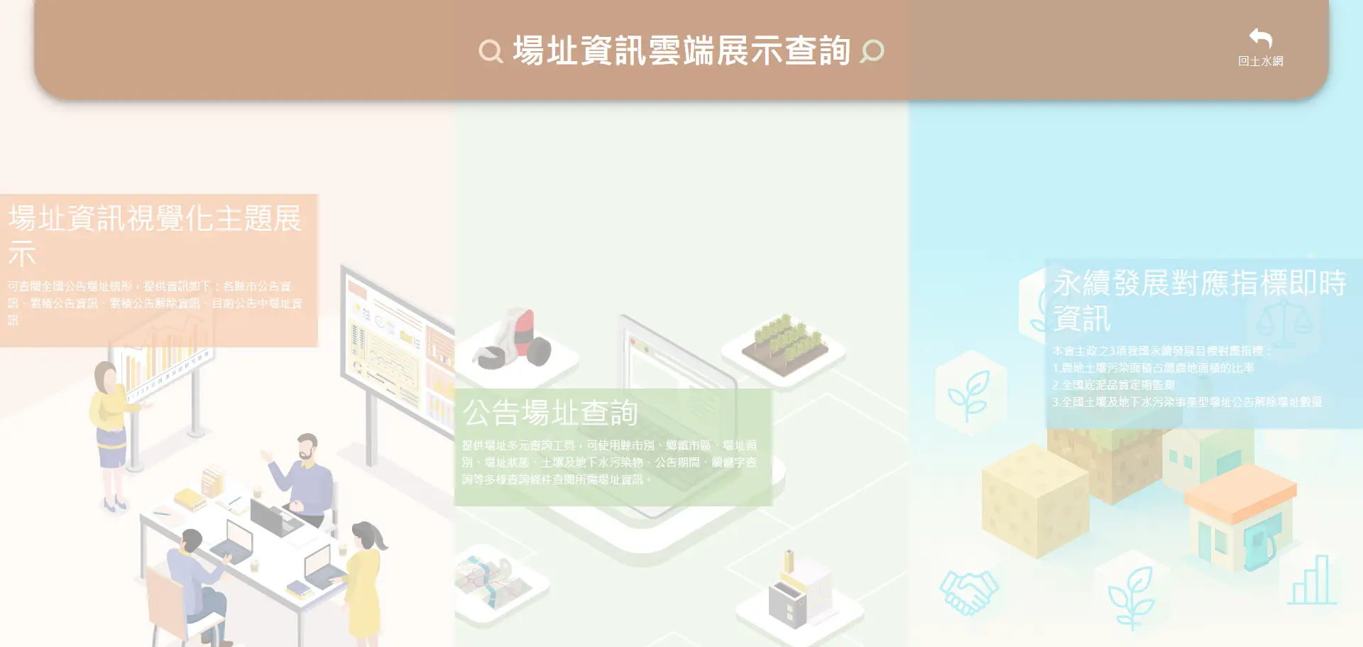
The Soil and Groundwater Pollution Remediation Fund Management Board (hereinafter referred to as the "Management Board") lists sites that affect normal land use or pose threats to public health and the living environment, according to the Soil and Groundwater Pollution Remediation Act. In 2002, the Soil and Groundwater Pollution Remediation Website was launched, allowing the public to learn about the Management Board's functions, relevant regulations, and achievements of soil and groundwater-related initiatives. The website also provides an Online Display Query for Site Information, which offers two main features: the Thematic Visualization of Site Information summarizes key national site data into five themes, enabling citizens to access essential site data efficiently; the Listed Site Search allows users to search by county and city, pollution type, pollutant type, and specific address to gain insight into the quality of soil and groundwater in their vicinity. Please refer to the following image for relevant interfaces.
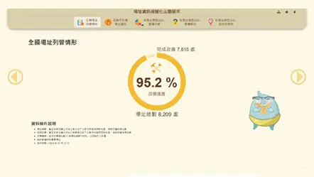
Since its establishment in 2001, the Management Board has accumulated over 20 years of data on listed sites. To make data on relevant sites more accessible, the website organizes the information into five main thematic queries, including National Site Listing Status, Site Information by County and City, Percentage of Sites by Type—Cumulative Listings, Percentage of Sites by Type—Cumulative Delistings, and Percentage of Sites by Type—Currently Listed. These visualizations allow the public to quickly understand relevant works and results. Citizens who wish to learn about site improvement efforts in their county or city can use the interactive query feature in Site Information by County and City, selecting their county or city on a map to view the latest site listing statistics. For more information, please refer to the Online Display Query for Site Information.
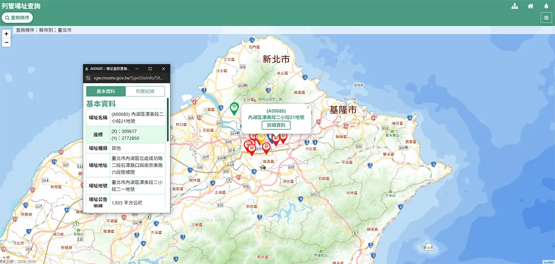
To meet different public information needs, users can perform simple queries by entering keywords such as county and city names or addresses. For advanced queries, users can refine their search by selecting pollutants and other factors, with nine search criteria available to accommodate various site inquiry needs.
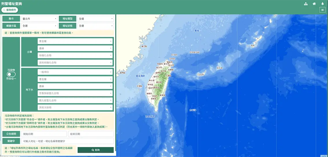
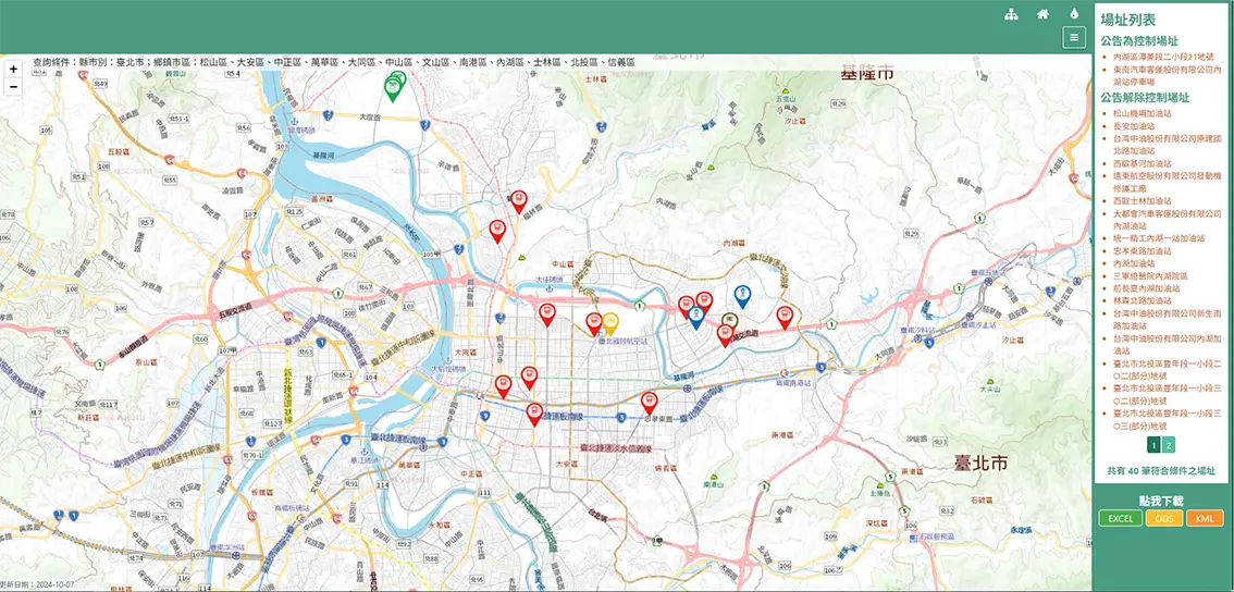
After setting search criteria, the results are shown on a map, allowing for geographic confirmation. Additionally, a list of sites that match the search criteria is displayed and sorted by site status, making it easier for users to locate specific sites. For more detailed site information, users can click on an icon on the map or select the site name from the list to view basic site data, listing records, and other information. Different site types are displayed with unique icons to help distinguish categories.
For land transactions or neighborhood soil and groundwater quality monitoring, historical data of listed sites is available on the Soil and Groundwater Pollution Remediation Website.


- Data Source: Soil and Groundwater Pollution Remediation Fund Management Board
- Publish Date: 2024-11-28
- Update Date: 2026-06-11